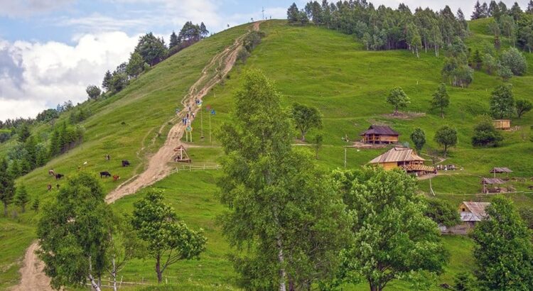
Makovytsia Mountain is one of the highest peaks in the town of Yaremche, part of the Gorgany mountain range. Located east of the central part of Yaremche within the Carpathian National Park, it may only be 984 meters high, but the views from the top are breathtaking.
The view from the top
From the treeless summit, you can enjoy a panoramic view of the Carpathian Mountains. To the south, you can see the Kukulskiy ridge, and on the very edge of the horizon, the highest peaks of the Chornohora ridge: Popivan, Hoverla, and Petros. Around Makovytsia, on three sides, the deep valley of the Prut River darkens, and to the west, the Dovbushanky ridge.
History
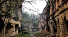
The summit and slopes of Makovytsia are scarred by trenches dug during the First and Second World Wars. During this period, heavy fighting took place here. Historically, Makovytsia Mountain and the surrounding area are known for the battles between the Austro-Hungarian and Tsarist troops in the First World War. A cross was installed on the mountain in memory of those who died.

The name
There are two versions of the origin of the mountain’s name. According to the first, it comes from the Ukrainian word “makivka”, which means “top”. Indeed, the views from the top of Makovytsia are magnificent. Another version claims that the name comes from the Sanskrit word “makuta”, which means “crown”. This is because in ancient times, the mountain was considered a sacred place and was used for pagan rituals.
Hiking to Makovytsia
Although Makovytsia Mountain is relatively low (984 meters), it offers stunning panoramic views of the picturesque mountain landscapes: the Yavirnyk ridge, the peaks of Khomyak, Synyak, and Dovbushanka. During the First and Second World Wars, fierce battles took place here, so you can still find shell casings underfoot from time to time. During the ascent, you will come across thickets of berries, hayfields, and pastures. You will pass through an ancient forest, past huge rocks where, according to legend, Oleksa Dovbush hid, and you will also come to an open meadow from which you will have a view of almost the entire territory of the national park.
The hike to Makovytsia Mountain is ideal for beginners. All paths have signs, so it is almost impossible to get lost. There are several paths leading to the mountain – from Dora, Yamna (villages of Yaremche) and from the parking lot near the souvenir market in Yaremche itself. The best choice would be the last path: a winding path leads through an incredibly beautiful beech-juniper-spruce forest. The route is marked. The color of the marking: horizontal white stripes, with a green stripe in the center. It starts from Ivan Franko Street, which turns into a mountain path and leads us to the very top.
How to get to Makovytsia Mountain
You can get to Makovytsia Mountain by car, bus, or train.
- By car: The easiest way to get to Makovytsia Mountain is by car. The journey from Ivano-Frankivsk takes about 2 hours.
- By bus: There are regular buses from Ivano-Frankivsk to Yaremche. From Yaremche, you can take a taxi or walk to the mountain.
- By train: There are regular trains from Ivano-Frankivsk to Yaremche. From Yaremche, you can take a taxi or walk to the mountain.
Tips for hiking Makovytsia Mountain
- Wear comfortable shoes and clothing.
- Bring water and snacks.
- Be aware of your surroundings and be careful not to get lost.
- Respect the environment and leave no trace.
Conclusion
Makovytsia Mountain is a beautiful and historic place that is perfect for a day hike. The views from the top are breathtaking, and the hike itself is relatively easy. If you are looking for a challenge, you can try hiking to the top of Makovytsia Mountain in the winter.